1.
Historically, the direction of urban expansion of Dhaka has greatly been constrained by the low elevation of lands, surrounding rivers and risk of flooding also geomorphologic and hydrologically Dhaka city are greatly vulnerable to seasonal inundations. The present paper discusses comparative analysis of urban growth and flood risk in newly buildup urban areas of Dhaka, Bangladesh. Both primary and secondary data have been used in the present research. This study suggested comprehensive measures including structural and non structural measures that will be included a number of flood control and mitigation programs as well as alternative valuable resources for urban planners and decision makers to devise sustainable land use and environmental planning.
eographically Dhaka is located between 23º 58´ and 23º 90´ North latitudes and 90º 33´ and 90º 50´. East longitudes, topographically, the area is a flat land and is located mainly on an alluvial terrace, popularly known as the Modhupur terrace of the Pleistocene period [1]. Dhaka is surrounded by four major river systems, namely the Buriganga, Turag, Tongi and Balu, which are flowing to the south, west, north and east sides, respectively. Dewan and Yamaguchi (2008), [2] found their study that Dhaka expanded rapidly between 1960 and 2005, the amount of urban land increased from 11% (in 1960) to 34% (in 2005). The surface elevation of the area Dhaka are ranges between 1 and 14 m and most of the built up areas located at the elevations of 6-8 m [3]. The previous study about Dhaka city considering the hydrological aspects found that the surrounding rivers like the Buriganga, Turag, Tongi and Balu,(Fig- 1) are mainly fed by local rainfalls and also receive spills from three mighty rivers crisscrossing the country, namely the Ganges, Brahmamaputra and Meghna through their tributaries and distributaries in the monsoon. In terms of geomorphologically, hydrologically and socioeconomically the newly built-up northeastern parts of Dhaka city are greatly vulnerable to seasonal inundations.
Both primary and secondary data have been used in the present research. Composition of the total inundated area and extended urban areas has been made on the basis of some recent satellite imageries, old and new city flood maps that exhibit the flood situation of Dhaka City, as well as ground survey and observations. Furthermore an elaborate questionnaire designed for the purpose of gathering information related to urban growth and historical flood hazard in Dhaka city of Bangladesh. The secondary information sources were various organizations such as Rajdhani Unnayan Kartripakhya (RAJUK), Bangladesh Water Development due to the destruction of the Cottage Industries of Dhaka. Moreover the establishment of small industries made Dhaka more important. After the independence of Bangladesh on December 16, 1971, the city"s population raised suddenly to 1403000 in 1974 [5]. The interpretation of the 2003 and 2005 land cover maps are indicated that Dhaka is being started to expand in all directions, specifically to north-east, south-east and southern trends by filling up low lying areas. Dhaka is expanding apace, at an average rate of 4.24% yearly projected to be the third largest mega city in the world by the year 2020 (World Bank).In order to lessen the flood susceptibility, earth filling is a very popular means of land development in Dhaka Metropolitan [5]. The earlier direction of the built up land was followed by north, north-west, and west trends, but the current trend shows a horizontal expansion [2].
2. b) Level of Urbanization:
Urbanization refers to the proportion of a nation"s population living in the urban areas. Its demographic meaning emphasizes largely on only two variables, population and location. The demographic approach focuses on location but it largely ignores individual behavior and the structure of occupations, in its most concise from it postulates that urbanization is a process of population concentration. Urbanization is indicated by an increase in urbanization over a period of time. For example, in 1981 the total population of Merul Badda one of extended urban area of Dhaka city was 32,120 and the urban population was 110 million [5]. Hence Un 81 = 110/32,120*10
The degree or level of Urbanization may be denoted as, U n = (U p /T p )*100;
Where U n : level of urbanization U p : Total urban population T p : Total population 0=0.34% The study explains an upward trend line of changing pattern of the level of urbanization. The level of urbanization of the study area is increasing gradually. 6Changes in land use are the end result of a variety of forces that drive the millions of separate choices made by individuals and governments. c) Flood Risk in Dhaka City of Bangladesh:
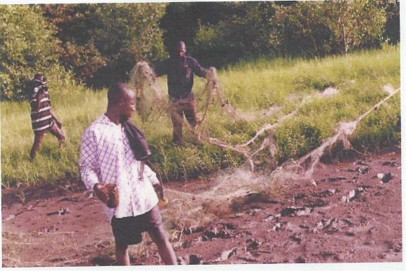
Regionally, the Dhaka is located in the central part of Bangladesh, and lies in the sub-tropical monsoon zone under the humid climatic condition. The city experiences about 2,000 mm annual rainfall, of which more than 80% occurs during the monsoon season [June-September].The city of Dhaka, especially its lower areas have been suffering from floods of varying magnitudes and nature. The extent of spread, depth, duration, frequency and overall nature of these floods are peculiar and greatly different from each other. Analysis of flood-data (i.e. hydrological reports) reveals that at least one eighth of total area of the city of Dhaka goes under water during a normal flood. However, during the time of some severe inundations (i.e. 1988 flood and 1998"s) about two-thirds or more area of the city was submerged under the floodwater [6]. Normally, the ordinary floods or rain-fed inundations of the city stay for shorter period. However, in the low-lying areas 1955, 1970, 1974, 1987, 1988, [7], 1998 and 2004 flood water went well in to the heart of the city consecutively. d) Flooded Area:
The total flooded areas of normal flood in and around Dhaka City is found to cover about 25 sq. km or about 17 percent of the urbanized area where 42.78 percent of the submerged area is under low land with an elevation of 1.5 to 5m heights. These areas cover some parts of Dakshin Khan in the northeast, Barua, Khilkhet, Dumni, Bahatra, Kallyanpur, Baunia, Chak Digun, lower part of Mohammadpur, Joarsahara and Badda (Fig- 2). During the severe floods of 1988, about 10 sq.km (11.75%) area of 6-13m elevation zone went under flood water in Dhaka City's urban area and 21.22 sq.km (29.67%) and 50.52 sq. km (33.93%) of 1.5-5 and 5-6m elevation zones were flooded respectively [6]. In total about 82 sq. km of about 66 percent of the area of the city was affected by this severe inundation of 1988. However, this was an unusual occurrence in the city. e) Depth and Duration of Normal Flood in Dhaka City:
The maximum and average depth of normal flood in Dhaka city is 5.7m and 3.0m respectively (BWDB 1989 andIslam 1996). In some areas of the city the depths of floods sometimes are being controlled or influenced by the local construction situation. The minimum and average flood duration in Dhaka City is 12 and 32 days respectively [3]. On the other hand, the depth of flood of 1987 was 1,0m in Uttar Khan while it was comparatively higher in Baunia and Bailjuri with a height of about 3.9m in the same elevation. This study find out that, recent unplanned urban development in Dhaka city of Bangladesh have directly impact on drainage system of the city, from the above discussion it is evident that the low-lying areas of the City of Dhaka, especially its eastern and western buildup fringes are greatly vulnerable to seasonal inundations. The study further reveals that the spree of recent urban growth and the associated structural development have significantly been affecting the urban-inundations and drainage failure in the City. The process of ceaseless human interferences in the form of encroachment in the lowlands (i.e., bils, Jheels, Khals, etc.) of the City and unplanned construction of roads, building embankments etc. in different parts of the city are also affecting the hydrological situation of Dhaka City. In the recent views, the drainage failures and the resultant flooding and submersions of parts of the City have been gaining momentum. Constructions of flood protection embankment in Demra area (DND) and Kurmitola area have proven to be a partial failure in achieving maximum benefits.
Only some appropriate integrated environment-friendly adjustment-oriented measures may bring some success in this respect. At the same time special attention need to be given to the facts that the normal natural settings i.e. morphological and hydrological situation of the City should not be disturbed in the process of urban-development. With this respect the endangered and extinct khals (channels) and, rivers and other existent important wetlands of the city should be preserved and saved for the sake of the smooth functioning of the City's choked and disturbed drainage system.

| Md. Abu Taleb |
| Abstract -Dhaka, the capital of Bangladesh could be the best |
| illustration of human activities and associated environmental |
| change. The capital Dhaka expanded rapidly between 1960 |
| and 2005 built up areas increased approximately 15,924 ha, |
| while agricultural land decreased 7,614 ha, vegetation |
| decreased 2,336 ha, wetland /lowland decreased 6,385 ha, |
| and water bodies decreased about 864 ha. The amount of |
| urban land increased from 11% (in 1960) to 34% (in 2005). |
| Year | Total Population | Growth Rate | Total Urban Population | Level of Urbanization |
| 1981 | 32,120 | 0.34 | 110 | 0.34 |
| 1991 | 45,000 | 0.83 | 240 | 0.53 |
| 2001 | 73,156 | 1.86 | 890 | 1.21 |
| 2004 | 76,615 | 2.45 | 1880 | 2.65 |
| 2008 | 85,032 | 2.74 | 2500 | 2.94 |
| 2015* | 90,758 | 3.43 | 3340 | 3.68 |